
El Niño vs La Niña: How Ocean Cycles Direct Global Weather
Sources reviewed: 2026-07-16
Definitions, thresholds, and safety guidance are checked against the primary sources listed below.
Almost every year you hear "El Niño" or "La Niña" in the news. They sound like distant scientific terms, but they quietly shape whether your winter is mild or brutal, whether hurricanes threaten your coast, and even why coffee and grain prices climb at the supermarket.
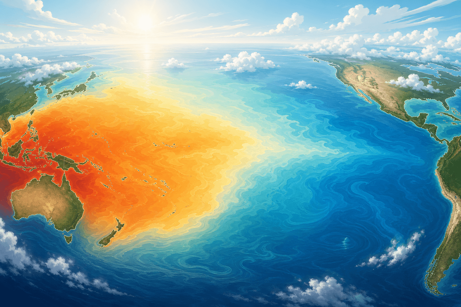
El Niño and La Niña are two extremes of the same natural cycle that scientists call ENSO (the El Niño–Southern Oscillation). It plays out in the tropical Pacific, yet its effects ripple to every corner of the globe.
ENSO: One Cycle, Three States
Think of ENSO as the "mood" of the tropical Pacific, swinging between three states — typically every 2 to 7 years:
- El Niño (warm phase): the central and eastern Pacific is unusually warm.
- La Niña (cool phase): the same region is unusually cool.
- Neutral: ocean temperatures are near average and neither dominates.
Importantly, ENSO shifts the odds and tendencies of global weather — it doesn't dictate any single day's forecast.
El Niño: When the Pacific Runs a Fever
What it is: unusual warming of the surface waters in the central-to-eastern equatorial Pacific (near South America). The name is Spanish for "the little boy," because South American fishermen often noticed the warm current around Christmas.
Typical effects:
- Western South America: heavier rain and flooding; weaker upwelling pushes fish away, hurting fisheries.
- Australia, Indonesia, SE Asia: more likely droughts and higher wildfire risk.
- Atlantic: stronger wind shear tends to suppress hurricanes, so the Atlantic season is often quieter.
- Global: usually nudges global average temperatures up and favors milder winters in northern latitudes.
La Niña: When the Pacific Cools Down
What it is: unusual cooling of the same surface waters — the mirror image of El Niño. The name means "the little girl."
Typical effects:
- North America: often colder, snowier winters in the north and drier conditions in the south.
- Atlantic: hurricane activity tends to be more active — bad news for the US East Coast and the Caribbean.
- SE Asia & Australia: wetter conditions and higher flood risk.
- Global: acts as a temporary cooling "brake," but not enough to reverse long-term warming.
Why Do They Happen? Trade Winds and the Walker Circulation
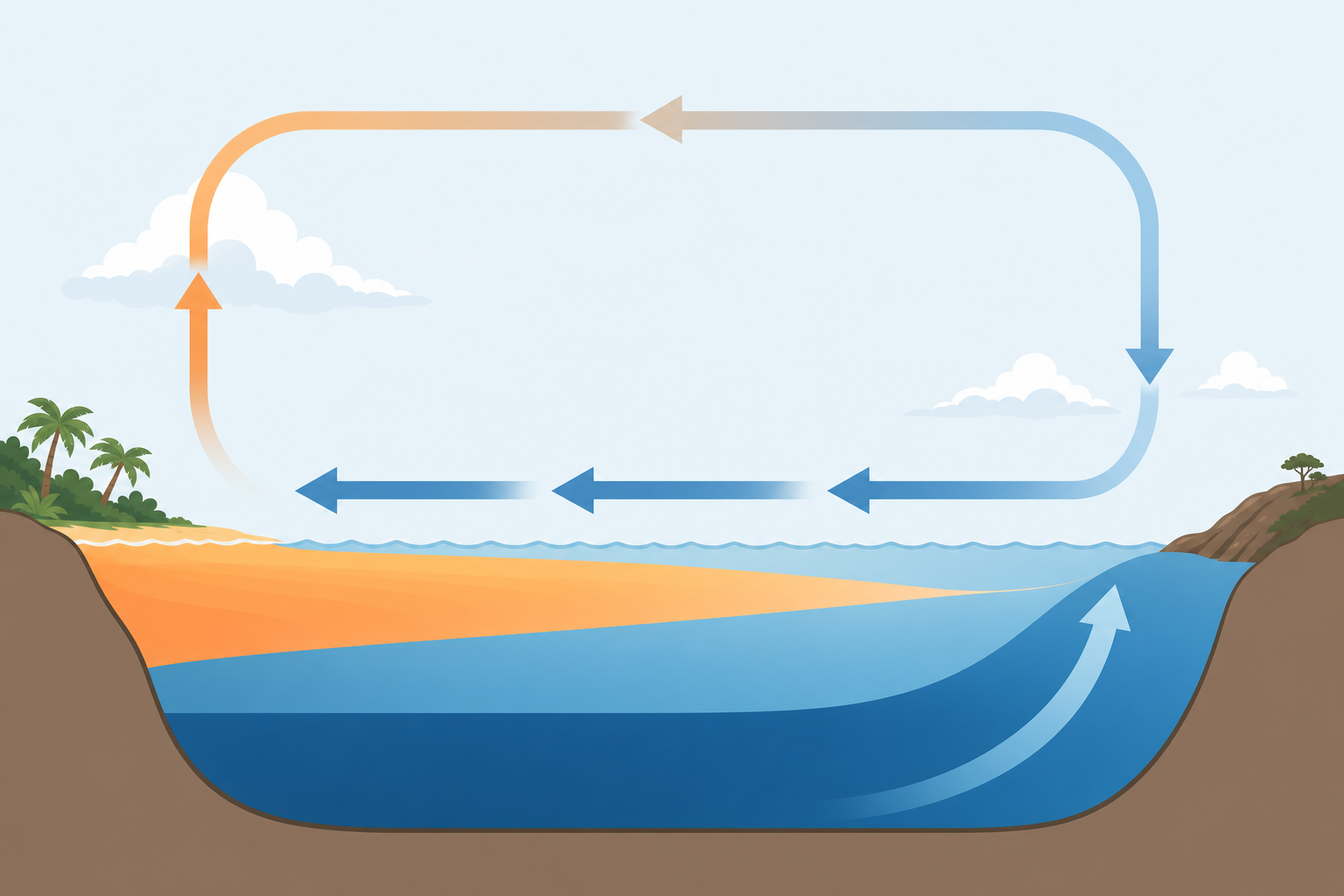
It comes down to the trade winds that blow across the Pacific. Normally they blow from east to west, piling warm surface water toward Asia, while deep, cold water rises (upwells) on the eastern side near South America. Above the ocean, a giant loop of air called the Walker circulation completes the pattern (shown above).
- During El Niño: the trade winds weaken or reverse, warm water sloshes back east, the circulation is disrupted, and rain belts shift eastward.
- During La Niña: the trade winds get supercharged, pushing even more warm water west and strengthening the cold upwelling in the east.
How Often and How Long?
ENSO events occur on average every 2 to 7 years, with no fixed schedule. A single event usually lasts 9 to 12 months, though strong ones can persist for a year or two. They typically peak during the Northern Hemisphere's late autumn and winter.
How El Niño and La Niña Affect You
- Food and your wallet: droughts and floods hit crops like wheat, rice, coffee and cocoa, pushing global food prices up.
- Travel and safety: shifts in hurricane activity, flooding and wildfires affect flights, itineraries and insurance.
- Energy and bills: hotter summers or colder winters change heating and cooling demand, moving energy prices.
- Health: extreme heat, wildfire smoke and the spread of some diseases can all shift with these cycles.
How Do Scientists Measure It?
Agencies continuously monitor a patch of the equatorial Pacific called the Niño 3.4 region. When sea-surface temperatures there stay more than 0.5°C above or below average for a sustained period, an El Niño or La Niña may be declared. NOAA uses the Oceanic Niño Index (ONI) to officially mark the start, strength and end of each event.
El Niño vs La Niña at a Glance
| Feature | El Niño | La Niña |
|---|---|---|
| Pacific sea temp | Warmer than average | Cooler than average |
| Trade winds | Weaker | Stronger |
| Global temperature | Higher | Briefly lower |
| Atlantic hurricanes | Suppressed | More active |
| S. America / SE Asia | Wet S. America, dry SE Asia | Wet SE Asia, dry S. America |
Remember it in one line
El Niño = warmer Pacific, hotter globe, fewer Atlantic hurricanes. La Niña = cooler Pacific, colder winters, more Atlantic hurricanes.
Source: NOAA (National Oceanic and Atmospheric Administration), World Meteorological Organization (WMO).
Sources and further reading
These primary sources were used to check definitions, thresholds, safety guidance, and scientific context.
Sources reviewed: 2026-07-16
- NOAA Climate.gov: El Nino and La Nina: Frequently asked questions
ENSO phases, mechanisms, typical impacts, and uncertainty.
- NOAA Climate.gov: Climate Variability: Oceanic Nino Index
How NOAA monitors tropical Pacific temperature anomalies.
What AnyWeather adds
We separate ENSO's probabilistic seasonal influence from claims about causing any single local storm.
This article is an independent synthesis of public sources; the listed institutions do not endorse AnyWeather. For weather or health risks, prioritize local official alerts and professional advice.
Frequently Asked Questions
What is the difference between El Niño and La Niña?
They are opposite extremes of the same ENSO cycle. El Niño is an unusual warming of the central-eastern equatorial Pacific with weaker trade winds, which usually warms the globe and suppresses Atlantic hurricanes. La Niña is an unusual cooling with stronger trade winds, which tends to bring colder winters and a more active Atlantic hurricane season.
How often does El Niño happen and how long does it last?
El Niño and La Niña occur on average every 2 to 7 years, with no fixed cycle. A single event usually lasts 9 to 12 months, though strong events can persist for a year or two, and they typically peak in late autumn and winter.
Does El Niño make the weather hotter?
Yes. El Niño usually raises global average temperatures and favors hotter years and milder winters. However, it shifts global-scale tendencies — the weather on any given day in a specific place still depends on local systems.
How do scientists know if an El Niño is happening?
They monitor sea-surface temperatures in the equatorial Pacific's Niño 3.4 region. When temperatures there stay more than 0.5°C above or below average for a sustained period, an El Niño (warm) or La Niña (cool) may be declared, which NOAA formalizes using the Oceanic Niño Index (ONI).
Related Articles
Understanding Air Quality Index (AQI): Everything You Need to Know
What is AQI? How is it calculated? What do the different levels mean? This article explains the Air Quality Index to help you protect your respiratory health.
ReadHeat Index vs Feels Like: What's the Difference Between Actual and Feels Like Temperature?
Why does 20C sometimes feel like 10C? It's all about the 'Feels Like' temperature. Learn about wind chill and heat index to dress smarter.
ReadWhy Is the Polar Vortex Moving South? The Science Behind Cold Snaps
Whenever a cold snap hits, 'polar vortex' headlines explode. Is it a monster storm? No — it's always there. Here's what the polar vortex really is, why it spills south, and how to stay safe in extreme cold.
Read